George H. Crosby Manitou State Park
About • Location • Activities • Ecology
Location
Size
6,159 acres statutory, 5,831 owned
Driving Directions |
||||
 |
||||
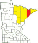
| Lake County | ||||
| Northeast Minnesota | ||||
Parking |
Entrance kiosk |
Hours |
Daily from 8 a.m. until 10 p.m. |
Fees |
Daily park permit: $7 Annual park permit: $35 |
Maps |
Activities |
Hiking Biking Mountain biking Horseback riding Picnicking Camping Backpacking Rock climbing and bouldering Swimming Boating Canoeing Birding Nature photography Geocaching Cross country skiing Skate-skiing Winter hiking Snowshoeing Snowmobiling |
Trails |
|
Hiking |
24 miles |
Mountain bike |
The CJ Ramstad/North Shore State Trail passes through the park in two short sections. Horseback riding, mountain biking, and snowmobiling are allowed only on this trail. |
Snowshoe |
Anywhere in park |
Hunting and Fishing |
The portion of the park which is east of the Manitou River and north of Minnesota Hwy. 61 (approximately 3,000 acres) is open to public hunting but closed to trapping. See Hunting and Trapping Regulations (MN DNR) for details. In most cases, Minnesota residents do not need a permit to fish in Minnesota State Parks. |
Ecology |
|||||
Ecological Classification |
 |
||||
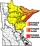
| Ecological Province | Laurentian Mixed Forest Province |
||||
| Ecological Section | Northern Superior Uplands |
||||
| Ecological Subsection | North Shore Highlands |
||||
| Land Type Association | North Shore Till Plain Sawtooth Mountain Bedrock Complex |
||||
Native Plant Communities* |
|||||
Alder - (Maple - Loosestrife) Swamp Aspen - Birch Forest: Balsam Fir Subtype Aspen - Birch Forest: Hardwood Subtype Beaver Wetland Complex Bedrock Shrubland (Inland) Bedrock Shrubland (Lake Superior) Black Ash - Aspen - Balsam Poplar Swamp (Northeastern) Crystalline Bedrock Outcrop (Northern) Dry Mafic Cliff (Northern) Dry Open Talus (Northern) Dry Scrub Talus (Northern) Exposed Mafic Cliff (Lake Superior) Graminoid Poor Fen (Basin) Low Shrub Poor Fen Lowland White Cedar Forest (North Shore) Mesic Mafic Cliff (Northern) Northern Mesic Mixed Forest Paper Birch - Sugar Maple Forest (North Shore) Poor Black Spruce Swamp Poor Tamarack - Black Spruce Swamp Sugar Maple Forest (North Shore) Upland White Cedar Forest Wet Mafic Cliff (Northern) White Cedar - Yellow Birch Forest White Pine - Red Pine Forest Young Forest Complex |
|||||
| * Source: The Minnesota Biological Survey, Minnesota Department of Natural Resources, Division of Ecological Resources | |||||
Natural Features |
|||||
|
|||||
Visitor Photos
Share your photo of this destination.
This button not working for you?
Simply email us at info@MinnesotaSeasons.com.
Attach one or more photos and, if you like, a caption.
Dan W. Andree |
||
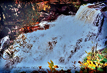 Manitou River Falls... I came across this old image of a waterfall on the Manitou River above the Hwy. 61 bridge. Right now there is a fire in an area of the George H. Crosby Manitou State Park on the Caribou River side. They closed the SHT between Caribou Falls and Co. Rd.7 due to the fire but George H. Crosby Manitou State Park remains open. I have been monitoring the Crosby Fire and so far it has burned 300 acres and is 70% contained. From the maps I had seen the fire has burned an area on a ridge area with in Crosby Manitou State Park and down the ridge toward Caribou River. It appears to have come quite close to the SHT in an area that traverses from the ridge area down toward caribou river. West Hill and Alpha Knob on the map were burned and on downward toward caribou river but not up to the river. The fire was started by lightning they stated. Since the fire was on the far edge of Crosby Manitou State Park it didn’t seem to do damage to Horseshoe Ridge main areas. At 70% contained, I believe they will get it out in the near future. While no one likes fires they are a natural occurrence sometimes. Blueberries etc. should do well in the future as they require open areas. It is possible new open views of areas not seen due to previous concealment by the forest be revealed as well. I am very familiar with the area that has burnt and still burning as it was mostly a downhill easier hike going toward Caribou Falls coming off the Horseshoe Ridge area. Easier going down than up. … |
||
 |
 |
|
Manitou River... … George Crosby Manitou is this Minnesota State Park Vehicle sticker. Caught brook trout in this tannin stained river. Loved being there. |
||
Tannin Stained Water... I had done a little experiment with some birch tree leaves back in 2023 just to see if the water would color. |
||
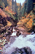 Manitou River Gorge... This photo is from Sept. 2001 of the manitou river falls looking down into a gorge area. This falls is also the one whitewater kayakers refer to as “Rain Falling Up” as at high water level there is so much mist it rises upward like rain falling up before coming back down. Also kayakers always take out of the river before this falls area due to the danger of serious if not deadly injury trying to attempt it. Though this image shows a much lower water level than kayaking season. I spent time in this area back then and have swam up into some areas of the gorge a couple times at low water levels. Today it is pretty much off limits in this area of the river as well as below Hwy. 61 on down to Lake Superior. I imagine as more people became aware of the area the landowners had to become more strict far as allowing people to access the area. If someone would get injured the landowners could possibly face liability charges and in todays world possibly being sued in a lawsuit. I climbed down at times and would view the falls from below on that flatter rock area on the right side below. The image doesn’t show the entire top part of the waterfall its a bit taller than shown. I wanted to get the winding river in how it kind of snakes its way through the rocky gorge area. |
||
 |
 |
|
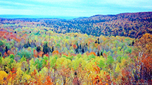
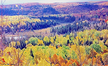
Manitou River Valley... Autumn Manitou River Valley with Lake Superior off in the distance. |
||
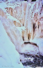
Manitou Falls February... Some ice formations around the falls. The river was frozen over most areas but part of the falls was flowing. The very top part was still ice and snow covered. In the gorge there were other ice formations in areas. Some with different color tints to the ice but I didn’t get any good photos at least that I can find. This was also from late Feb. 2002. This is pretty interesting and one can see some natural tannin staining in the ice formation coloration. |
||
 |
 |
|
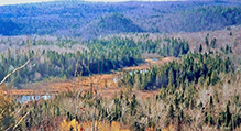
Oct. Beaver Ponds Manitou River Valley …my favorite beaver ponds
|
||
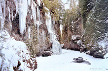
Winter Manitou Gorge Feb. 2002 Only time I been up the North Shore in winter. Winter Wonderland it was. |
||
 |
 |
|
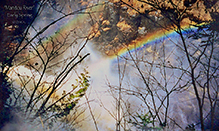
Early Spring Manitou River Falls... This was from one April along the Manitou River. The river was the highest level I had seen and a mist bow and at times a double mist bow appeared from all the spray along with the sun coming out at times. There is quite a story that goes with this visit that early Spring, but it could be a bit too long to tell. |
Fall hike These ponds are encompassed on three sides by Horseshoe Ridge and the Manitou River on the other. Fog was diminishing over on Lake Superior and the sun was shining in between some clouds here and there. Anyway it was a beautiful fall day. |
|
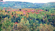 Maples Turning... This is from an early fall hike. It almost always seemed these maples would start turning first in this spot in the fall. The Manitou river is almost straight down quite a ways below where I was standing. There are steep hills that rise around 300 ft. or so in some areas. I have explored the river between steep hills while fishing for brook trout. If the hills were any steeper they would be cliffs. The hills across the river is where the SHT traverses to the Horseshoe Ridge area and beyond and over and down to the Caribou River. If the Manitou river area by Lake Superior were open to the public like the Caribou and other rivers a lot of people would be checking that area out too just like they do the Caribou, Cascade etc etc. Several years ago people could park by a gate on the up side of Hwy 61 maybe a quarter mile from the Manitou river bridge and walk an old road to the river. I use to do that but today it isn’t allowed. But I swam up into the gorge that is just above 61 a couple times and also hiked up to a good sized waterfall that drops into the gorge. The land owners didn’t ever confront me or anything and I went there several times over several years. I hiked into that gorge one late Feb. day back in 2002 when Bob Silver had passed away. The river was froze in most spots but I knew where any deep spot was so went into the gorge and explored it. A lot of ice formations on the canyon walls. Some different colored from basic regular white to an ice blue or somewhat aqua and some honey colored etc. One of the neatest places I had ever been to in winter. The main big falls above 61 kayakers call it “Rain Falling Up Falls” due to at high water when some do kayak the Manitou they have to take out before that falls. It cannot be run and never has been. I could see why due to the shape of the gorge entrance and the twists and turns of the river and how narrow between rocks through the first part of the gorge. I do believe the waterfall that dumps into Lake Superior has been run by experts but that one is a bit different than the one above 61. I think the land owners by 61 do not allow ice climbing in the gorge anymore either unless you have permission and I think sign a document so they couldn’t be sued should someone get hurt. But it use to be a popular ice climbing area above 61 on the Manitou and still is with those able to get permission etc. I remember the Parks & Trails Council years ago wanted to purchase that land down there and open it to the public but I guess that John Driscoll wouldn’t sell or allow it. I was a member of that Parks & Trails Council back then and a Dorian Grilley if I remember right was the President of the Parks and Trails and he told me over the phone John Driscoll had his lawyer along and he wasn’t interested in selling his property along the lower Manitou so that ended that. I often wondered with Crosby Manitou being a backpacking park only how it would work out down at the lake since just regular tourists would be packing the area if that area ever was open to the public. Anyway I guess it will remain one of the few undeveloped spots on the Lake Superior Minnesota shore which I don’t mind. Seems like some tourists or just some people in general lack appreciation for nature or other peoples property and leave trash etc. Rain Falling Up Falls... Kayakers called it that because there was so much mist rising up it was like the rain was falling up. … I been there one April and it was really gushing over the falls and that falls has a different shaped pool below it compared to other falls. It gets a lot of spray that does rise up like rain falling upward I guess before it comes back down. Its not that it is such a big waterfall its just how its laid out with a sharp right turn right at the different shaped pool below with a rock wall in front a kayaker would be slammed into. Then the river also kind of zig zags in a narrow area and here are a couple small falls below as it continues on into the gorge. Once into the main gorge it settles down until the next falls on the lake side of Hwy. 61. After that falls which is nice too there is another narrow gorge/slot canyon as some refer to them with some rapids and a few very small waterfalls then its final falls dropping into the big lake. It's a very scenic area. |
||
 |
 |
|
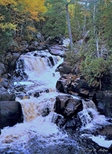
Manitou Cascades... From a hike one fall season at George H. Crosby Manitou State Park. I had fished this river and caught some brook trout. Beautiful park. |
||
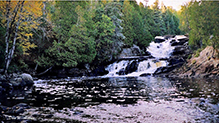
Cascading Waterfalls... Early Autumn Manitou River in George H Crosby Manitou State Park. I came across this scene while brook trout fishing early one the fall season. |
||
|
||
 |
 |
|
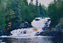
Manitou River Cascades... This was taken during an early fall hike and a little higher river flow in George H. Crosby Manitou State Park. |
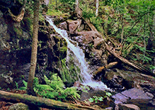
Waterfall on a tributary stream flowing into... the Manitou River in George H. Crosby Manitou State Park. |
|
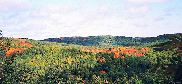 Seen the Forest for the Trees... This is from one fall hike I took at George H. Crosby Manitou State Park. The state park trail traversed up and along some steep hills. Not many open views the forest is quite dense. The Manitou river was a couple hundred feet or so almost directly below me. I couldn’t see it the dense forest blocked it out, but I could hear it. I came to an opening in the forest and the view across the river which is now also part of Crosby Manitou State Park had maples turning here and there and the the sun peaking out between clouds leaving cloud shadows on the hills and valley caught my eye. A real memorable fall scene during that fall outdoor adventure. Beautiful hills and valley and the sound of the river rushing below. Now I know how some say they have seen the forest for the trees. 😊 |
||
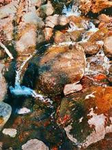
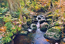
2 small creeks that flow into the Manitou River... These 2 small creeks flow into the Manitou river in George H. Crosby Manitou State Park. Nice little creeks. |
 |
|
 |
||
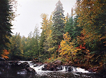
Autumn along the Manitou River Trail in... George H. Crosby Manitou State Park. I think fall is my favorite time of year for hiking. It’s cooler for hiking rugged trails and the fall colors can be really beautiful even on overcast days with fog lifting and occasional light mist like here along the Manitou River. |
 |
|
Rapids on the Manitou River... This was a really neat spot on the Manitou River in George H. Crosby Manitou State Park. One September day while there I caught a really colorful brook trout. It was only about 7-8 inches in length but just a beautiful fish. I released it carefully back into the river. I had previously hiked the river trail down to the farthest campsite checking out the river, campsites and also some tiny feeder creeks. Over several years and seasons I had gotten to know the area well. Beautiful area. |
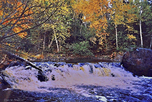 |
|
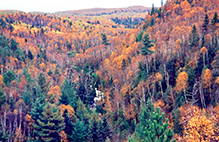 Oct. Manitou River ... George H. Crosby Manitou State Park. This isn’t a regular overlook there. This park is quite rugged and densely forested and though I could often hear the river a good distance below actually getting a glimpse of it wasn't so easy to find. Trees often block the view below. I somewhat bushwhacked to see if I could safely find a view of the river cascading below. I wouldn’t recommend anyone trying to do the same. Also this image is from some years back so there is more than likely even more overgrown and even harder and likely more dangerous to find a view. I’ve hiked several times in the past on the Superior Hiking Trail from George H. Crosby Manitou State Park on over to Caribou River State Wayside. Most of the hikes were in fall and a few in spring or summer. Seasons with less or smaller leaves on the trees offered slighting more open areas along the river. Kind of strenuous hikes but have a lot of real nice memories. |
||
 |
||
Manitou Cascades... From a hike one fall season at George H. Crosby Manitou State Park. I had fished this river and caught some brook trout. Beautiful park. |
|
|
MinnesotaSeasons.com Photos
|

Slideshows
George Crosby Manitou State Park
Richard Sanders

Visitor Videos
Share your video of this destination.
This button not working for you?
Simply email us at info@MinnesotaSeasons.com.
Attach a video, a YouTube link, or a cloud storage link.
Other Videos
Manitou Falls
Minnesota State Parks and Trails
W4F - Webisode #6 "Manitou State Park" Tips on Fishing, Camping & Hiking
Wish4FishTV
The Hill of Death
Roustabout103
Field Testing Team Realtree Energy Drink
supertasterdaily
Autumn Leaves 2011
moss13

Visitor Sightings
Share your sightings or comments about of this destination.
This button not working for you?
Simply email us at info@MinnesotaSeasons.com.
Dan W. Andree |
Comments
10/17/2025
Crosby Wildfire Map...
… Alpha Knob is a rock outcrop and the Little Caribou River (a tributary to the main Caribou River) is down below and there are steep hills on the other side of it. Little Caribou has no name on a map Bob Silver told me that is what he called it so I just did too. I did venture out to it following one of Bob Silvers old logging roads several years ago and did catch one very small brook trout in that tributary to the main Caribou River. I carefully let it go.
But glad they got the fire out and I believe the SHT is now open in that section. Most of that area burned is part of the Caribou River Watershed but I don’t think it will have to big of an impact on that watershed.
This fire was a natural occurrence started by lightning and not by someone careless with a campfire or even worse arson like some fires. But I can see why they would definitely close the SHT temporarily in that area and also since the fire was far enough away from the campsites in George H. Crosby Manitou State Park campground areas etc. they could keep that area open. I think in the years ahead it will be really interesting and educational for some to see how the area recovers with new growth etc.
10/14/2025
That Crosby Fire...
Is now 85% contained and still at 300 acres .. I have been monitoring it online and seems like it won’t be to long before they get it all under control. Weather has been favorable and rain is forecast for the 15th. First time I heard of any fire near the SHT. …
2/12/2024
It was around...
Early Oct. 2001 I stopped by the caretakers residence to see if I could go look at the falls that dumped into Lake Superior. A Vaughn Hoff was the caretakers name I believe at that time. I told him who I was and he mention oh yeah you know John? I think I told him John said next time up the shore to stop by and I could go see the falls by the lake etc. But anyway the caretaker told me where to go. I drove to an area with a parking area and there was a mansion near the lake. I knocked but no one came to the door. 2 men drove up and it looked like they were maybe doing some type outdoor work and told me where a path was to get to the falls etc. One young man said you going to go look at the caves? I replied the waterfalls etc. He said there are some pink salmon in the pool below the falls at the lake now too. So anyway I went and checked things out. There is a cave in the side of a rock wall at the lake near the waterfall. I noticed some small ones in the gorge above that falls but didn’t go close since one had to walk in the river to get to them. I wasn’t prepared for that I guess at that particular time.
But anyway I found one photo with a date on back stamped Oct. 2001 but I received the letter from John Driscoll some time before that just never stopped by before. At times when salmon are in the pool bald eagles will show up. Pink salmon die after spawning and the eagles feed on the dead or dying salmon sometimes. There were no dead or dying pink salmon in that pool when I was there and I didn't see any eagles around. It looked like the salmon were just starting to swim up. They can’t get far upstream since the falls is a barrier right there. Most other N. Shore streams have a longer stretch before a barrier falls. I don’t mind that the lower Manitou river is off limits. It’s a rarity today for an undeveloped area like that along the Minnesota North Shore stretch. Also people would trample a lot of vegetation and my guess is kayaks would be all over below the falls and people walking a looking all over in the above area. Bald eagles wouldn’t be able to feed on the salmon with people all over. The landowners do seem to take really good care of that lower area. =
2/9/2024
I should probably mention...
Back in 2002 the landowners weren’t real strict about accessing the waterfall on the upper side of the Hwy. 61 Manitou river bridge. Today they are. Back on Feb. 2002 I parked on a side road not that far up 61 from the caretaker of the lower manitou river area. There was a metal gate blocking anyone from driving closer to the river. I parked at the gate and walked up that old road to the river. The caretaker and even landowners could see my vehicle plain as day but they never bothered me. It was the same back when I visited the falls kayakers gave the name Rain Falling Up and I the 2 lost hikers found me below the that falls. There is more to that story than I already filled you in on. It is pretty person so wasn’t sure about how much detail to go into.
Back then it was actually an Easter weekend. I had been living with my mother who was battling cancer. Someone had to live with her or she would have ended up in a Nursing Home. Being single, no kids etc. I was the most logical choice of everyone in the family. It had been a couple years and I needed a break. All the family members were coming to my mothers home that Easter and there were quite a few. I spoke with my mother and asked her if she minded if I took a little break since everyone was coming home for a few days? She said oh yes, you need a break and I will be having so much company. So that is when I decided to head up the North Shore.
I arrived on a Friday and got a motel room in the Finland area. They were cheaper back then though now a bit higher. I explored George H. Crosby Manitou State Park and there was some snow that April yet in the park. The river was open in areas but some had snow cover and ice. Saturday I went to the falls closer to Lake Superior and checked out the falls which were just roaring with spring runoff. I hung around that area for a while then left. I struggled that Saturday if I should stay or head back because I could still make it back home for Easter. I was feeling a little guilty leaving my mother I guess. I remembered my mom agreeing I needed a little time away and that she had so much company coming. So I stayed. Easter morning which was a Sunday something tugged at me to return to that waterfall up river from the Hwy. Manitou River bridge. I couldn’t understand it really since I had just been there the day before. So I went to that area and it was pretty much the same as the day before only that it was Easter Sunday.
Though I stated in the previous email I went below that falls and got sprayed which I did. That Sunday I stood wondering why I was there again. I looked around and just kind of hung out a little then wondered again why am I here? I was just here yesterday. I finally said… Okay God, why am I here? It was a few minutes maybe then the 2 men showed up on top the falls. You know the rest of the story from here. While they weren’t far from Hwy 61 there vehicle was back in either Crosby Manitou State Park or the Caribou River State Wayside. I guess I never asked the Tettegouche Park Personnel where their vehicle was parked. My guess is inland at Crosby Manitou State Park or if they were doing the hike from the State Park on the SHT over to Caribou Falls stretch maybe a car there. Either way once on Hwy. 61 a distance yet and would have had to try catch a ride. This event was before 2002. My guess is Tettegouche State Park personnel wouldn't remember it unless they keep records. I didn’t want to give the exact year only for the reason people might think man that’s a long time ago. How old is he? I’m not young, but I’m not that old either. I’ll tell you what year it was. It was the weekend of Easter 1998. It was also the year my mother passed away. Some may think I should feel guilty not being home at my mothers last easter, but I really don’t. She was glad I got to get away and she filled me in on all the company and what went on. I told her about the 2 lost hikers and she said I’m glad you got to see some things and help those to lost hikers find their way out. Also I don’t remember my mother for just one easter or one certain event but mainly for her life time.
2/8/2024
That previous waterfall with the mist bows was that falls Kayakers call "Rain Falling Up". That one early spring I managed to get below it and mist was rising upward and in my face then falling back down on my head etc. But I liked it. I wasn’t right up to it which would have been dangerous as the rocks etc. were wet. So I backed way off behind some trees etc. Not long after, I looked up to the top of the falls and 2 men were up there. The younger one waved and was trying to get my attention, but I didn’t know what he wanted. So I climbed back out of the gorge and hiked up river to get directly across from the 2 men. The younger one stated they were lost and had been for 2 days. I yelled across the river information how to get out and down to the Hwy. 61 and they started walking away. I started to head back down river myself I glanced over toward the 2 men and seen a glimpse of them between the trees but heading the wrong way. I got back to my vehicle and headed back down the shore stopping at Tettegouche State Park and went in and told Park Personnel about the 2 lost hikers and I told them how to get out but seen them heading the wrong way. They asked if I could show them on a map the location I seen them and describe what they were wearing so I did. I was asked to stay at Tettegouche in case they needed more info. Park Personnel went out looking for them and did call and state they found them. They said it was good I described them because they seen 2 other men somewhat in the area but didn’t match the description I gave.
I called Tettegouche State Park some time after I got home and asked about the 2 men. I was told they didn’t say much all the way back to their automobile. One was a Minister and was suppose to be back giving a sermon. It was a Sunday I happen to come across them. The minister was middle age, had glasses, a somewhat safari like hat on and a big backpack. The younger guy a bandana over his head, a large backpack and a hiking pole in his hand. I am sure the raging waterfall from the top and opposite side was somewhat scary looking at least to the older guy who stood in the background while the younger man came closer to the edge. The falls is pretty dramatic from the area they were standing. But anyway kind of a long story. I omitted some details like the date, year, reason I was there at that particular time etc. But it was some time back but thinking I was meant to be there.
Christa Rittberg |
MinnesotaSeasons.com Sightings |
Visits |
5/26/2011 |
Fungi and Lichens
One fungi and lichen species with conservation status in Minnesota has been seen here:
Special Concern
Pale-footed Horsehair Lichen (Bryoria fuscescens)
Insects and Arachnids
Plants
Fourteen plant species with conservation status in Minnesota are found here:
Threatened
alpine woodsia (Woodsia alpina)
Braun’s hollyfern (Polystichum braunii)
longleaf arnica (Arnica lonchophylla)
New England sedge (Carex novae-angliae)
rock clubmoss (Huperzia porophila)
smooth woodsia (Woodsia glabella)
Special Concern
Douglas hawthorn (Crataegus douglasii)
Fernald’s false manna grass (Torreyochloa pallida var. fernaldii)
Hudson Bay eyebright (Euphrasia hudsoniana var. ramosior)
intermediate sedge (Carex media)
Mingan moonwort (Botrychium minganense)
slender spikerush (Eleocharis nitida)
small green wood orchid (Platanthera clavellata)
snowline wintergreen (Pyrola minor)
Minnesota Biodiversity Atlas and Minnesota Biological Survey Vegetation Releves Plant List
Plants frequently found in:
Alder - (Maple - Loosestrife) Swamp FPn73a
Aspen - Birch Forest: Balsam Fir Subtype FDn43b1
Aspen - Birch Forest: Hardwood Subtype FDn43b2
Bedrock Shrubland (Inland) ROn23a
Bedrock Shrubland (Lake Superior) ROn23b
Black Ash - Aspen - Balsam Poplar Swamp (Northeastern) WFn55a
Crystalline Bedrock Outcrop (Northern) ROn12b
Dry Mafic Cliff (Northern) CTn11a
Dry Open Talus (Northern) CTn12a
Dry Scrub Talus (Northern) CTn24a
Exposed Mafic Cliff (Lake Superior) CTu22a
Graminoid Poor Fen (Basin) APn91b
Lowland White Cedar Forest (North Shore) WFn53a
Mesic Mafic Cliff (Northern) CTn32a
Northern Mesic Mixed Forest FDn43
Paper Birch - Sugar Maple Forest (North Shore) MHn45a
Poor Black Spruce Swamp APn81a
Poor Tamarack - Black Spruce Swamp APn81b
Sugar Maple Forest (North Shore) MHn45c
Upland White Cedar Forest FDn43c
Wet Mafic Cliff (Northern) CTn42a
