![]()
![]()
![]()
![]()
Whitewater WMA
Main Branch Unit
About • Location • Activities • Ecology
About |
||
Ownership |
||
|
||
Links |
||
Overview |
||
|
||
History |
||
|
||
Management |
||
|
||
Comments |
||
|
||
Location |
||||
Maps |
||||
Printable Map(s) with GPS coordinates |
||||
Game Refuge, South Section |
||||
 |
||||
Size |
||||
21,664.3 acres |
||||
Parking |
||||
Minnesota DNR There are numerous parking lots on this huge WMA. N44 9.182, W92 0.980 N44 9.018, W92 0.407 N44 8.792, W91 59.710 N44 8.961, W91 58.316 N44 9.268, W91 58.234 N44 9.514, W91 58.353 N44 10.276, W92 1.225 N44 10.699, W91 59.782 N44 11.055, W91 59.749 |
||||
Driving Directions |
 |
|||||
| Wabasha nad Winona Counties | ||||||
| Southeast Minnesota | ||||||
Activities |
||
Hiking Trails |
||
There are numerous DNR management roads within the WMA. |
||
Hunting |
||
On the game refuge: closed to deer hunting and waterfowl hunting, open to small game hunting, wild turkey hunting, and trapping. Trapping is by permit only. Everywhere else: Deer, Small Game, Forest Upland Birds, Pheasants, Waterfowl, Turkey, Doves. See Hunting and Trapping Regulations (MN DNR) for details. |
||
Ecology |
|||||||
Ecological Classification |
 |
||||||
| Ecological Province | Eastern Broadleaf Forest Province | ||||||
| Ecological Section | Paleozoic Plateau | ||||||
| Ecological Subsection | The Blufflands Rochester Plateau |
||||||
| Land Type Associations | Altura Ridgetops Elba Slopes Lewiston Plain Whitewater River Valley |
||||||
Native Plant Communities* |
|||||||
(Partial list) Dry Barrens Prairie (Southern) Dry Barrens Oak Savanna (Southern): Jack Pine Subtype Dry Barrens Oak Savanna (Southern): Oak Subtype Dry Bedrock Bluff Prairie (Southern) Mesic Prairie (Southern) Oak - Shagbark Hickory Woodland Red Oak - White Oak Forest Southern Dry-Mesic Oak Forest |
|||||||
| * Source: The Minnesota Biological Survey, Minnesota Department of Natural Resources, Division of Ecological Resources | |||||||
Natural Features |
|||||||
|
|||||||
Visitor Photos |
|||||
Share your photo of this destination. |
|||||
| This button not working for you? Simply email us at info@MinnesotaSeasons.com. Attach one or more photos and, if you like, a caption. |
|||||
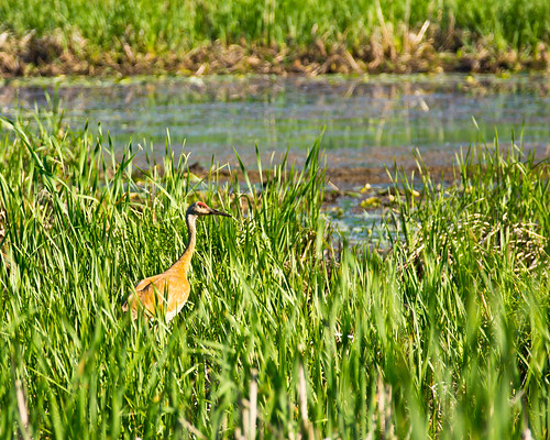
Nancy Falkum |
|||||
Landscape of Whitewater Game Refuge |
|||||
 |
 |
||||
MinnesotaSeasons.com Photos |
|||||
|
|||||

Slideshows |
||
| Whitewater MN State Wildlife Mgmt Area Rich Ryan |
||
 |
||

Visitor Videos |
|||
Share your video of this destination. |
|||
| This button not working for you? Simply email us at info@MinnesotaSeasons.com. Attach a video, a YouTube link, or a cloud storage link. |
|||
Other Videos |
|||
| WhiteWater WMA - The Hype MN-Made Adventures |
|||
About
Oct 30, 2018 This is a tribute to the WhiteWater WMA in Southeast MN. Many generations of memories have been made and many Giant Bucks have fallen here. Follow us as we pursue a Giant and make memories of our own. Song: Sappheiros - Lights (Vlog No Copyright Music) Music promoted by Vlog No Copyright Music. Video Link: https://youtu.be/kzeQK45StRo |
|||
| Project Get Outdoors at the Whitewater Wildlife Management Area Project Get Outdoors |
|||
About
Aug 5, 2021 27,000 acres of near wilderness to explore covering sections of Winona, Wabasha and Olmsted Counties. Check out the Whitewater WMA! |
|||

Visitor Sightings |
||||||||||||||||||||||||||||||||
Share your sightings or comments about of this destination. |
||||||||||||||||||||||||||||||||
| This button not working for you? Simply email us at info@MinnesotaSeasons.com. |
||||||||||||||||||||||||||||||||
Nancy Falkum |
||||||||||||||||||||||||||||||||
Fungi and Lichens |
||||||||||||||||||||||||||||||||
 |
||||||||||||||||||||||||||||||||
Plants |
||||||||||||||||||||||||||||||||
bloodroot (Sanguinaria canadensis) Canadian wild ginger (Asarum canadense) Dutchman’s breeches (Dicentra cucullaria) sharp-lobed hepatica (Anemone acutiloba) snakeskin liverwort (Conocephalum salebrosum) Virginia spring beauty (Claytonia virginica var. virginica) |
|
|||||||||||||||||||||||||||||||
MinnesotaSeasons.com Sightings |
||||||||||||||||||||||||||||||||
|
||||||||||||||||||||||||||||||||
Plants |
||||||||||||||||||||||||||||||||
Plants frequently found in: (Partial list)Dry Barrens Prairie (Southern) UPs13a Dry Barrens Oak Savanna (Southern), Jack Pine Subtype UPs14a1 Dry Barrens Oak Savanna (Southern): Oak Subtype UPs14a2 Dry Bedrock Bluff Prairie (Southern) UPs13c Mesic Prairie (Southern) UPs23a Oak - Shagbark Hickory Woodland FDs38a |
||||||||||||||||||||||||||||||||


Created: 6/28/2022 Last Updated: © MinnesotaSeasons.com. All rights reserved. |