Hardscrabble Woods/MG Tusler Sanctuary
About • Location • Activities • Ecology
About |
||
Ownership |
||
|
||
Links |
||
|
||
Overview |
||
|
||
History |
||
|
||
Management |
||
|
||
Comments |
||
|
||
Location |
||||
Maps |
||||
|
||||
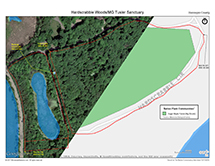
Printable Map(s) with GPS coordinates |
||||
 |
||||
Size |
||||
31 acres |
||||
Parking |
||||
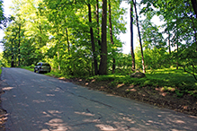
Park on the shoulder. N44 54.860, W93 40.681 |
||||
Driving Directions |
 |
|||||
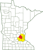
| Hennepin County | ||||||
| Metro Area | ||||||
Activities |
||
Hiking Trails |
||
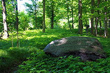
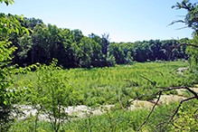
West of the road a well worn footpath leads from the memorial stone, around a pond, to a residential area south of the preserve. There are no maintained trails. |
||
Hunting |
||
No hunting |
||
Ecology |
|||||||
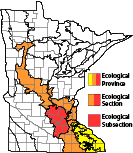
Ecological Classification |
 |
||||||
| Ecological Province | Eastern Broadleaf Forest Province |
||||||
| Ecological Section | Minnesota & NE Iowa Morainal |
||||||
| Ecological Subsection | Big Woods |
||||||
| Land Type Association | Maple Plain Moraine |
||||||
Native Plant Communities* |
|||||||
|
|||||||
| * Source: The Minnesota Biological Survey, Minnesota Department of Natural Resources, Division of Ecological Resources | |||||||
Natural Features |
|||||||
Sugar Maple Forest (Big Woods) |
|||||||
Dense Woodland
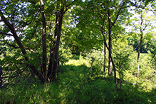
The larger section, east of the road, has a very dense canopy that extends beyond the road (Hardscrabble Circle) that surrounds the site. In this section there are no open areas and little edge habitat, resulting in sparse herb layer growth and almost no shrub layer growth.

Slideshows |
||

Visitor Videos |
|||
Share your video of this destination. |
|||
| This button not working for you? Simply email us at info@MinnesotaSeasons.com. Attach a video, a YouTube link, or a cloud storage link. |
|||
Other Videos |
|||

Created: Last Updated: © MinnesotaSeasons.com. All rights reserved. |

