Twin Valley WMA
North Unit
About • Location • Activities • Ecology
About |
||
Ownership |
||
|
||
Links |
||
Overview |
||
|
||
History |
||
|
||
Management |
||
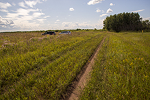
Parts of the site were disked and seeded in 2014. |
||
Comments |
||
|
||
Location |
||||
Maps |
||||
|
||||
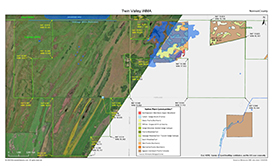
Printable Map(s) with GPS coordinates |
||||
 |
||||
Size |
||||
1,628.27 acres |
||||
Parking |
||||
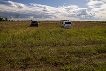
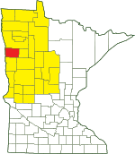
There is a parking area on the south side of 110th Ave. 600 yards west of 360th St. N47 9.951, W96 18.509 |
||||
Driving Directions |
 |
|||||
| Norman County | ||||||
| Northwest Minnesota | ||||||
Activities |
||
Hiking Trails |
||
No maintained trails |
||
Hunting |
||
Deer, Small Game, Forest Upland Birds, Waterfowl. See Hunting and Trapping Regulations (MN DNR) for details. |
||
Ecology |
|||||||
Ecological Classification |
 |
||||||
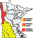
| Ecological Province | Prairie Parkland Province |
||||||
| Ecological Section | Red River Valley |
||||||
| Ecological Subsection | Red River Prairie |
||||||
| Land Type Association | Barnesville Beach Complex |
||||||
Native Plant Communities* |
|||||||
Agassiz Interbeach Prairie Complex Basin Meadow/Carr Cattail - Sedge Marsh (Prairie) Mesic Prairie (Northern) Northwestern Wet-Mesic Aspen Woodland Prairie Meadow/Carr Sedge Meadow: Beaked Sedge Subtype Seepage Meadow/Carr Wet Prairie (Northern) Wet Saline Prairie (Northern) Willow - Dogwood Shrub Swamp |
|||||||
| * Source: The Minnesota Biological Survey, Minnesota Department of Natural Resources, Division of Ecological Resources | |||||||
Natural Features |
|||||||
|
|||||||
Waterproof footwear recommended
![]()
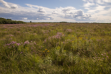
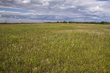
The recently acquired eastern section contains mesic prairie. The remainder of the site is mostly wet prairie. Visitors should expect “extremely wet conditions in June.”

Slideshows |
||
Visitor Videos |
|||
Share your video of this destination. |
|||
| This button not working for you? Simply email us at info@MinnesotaSeasons.com. Attach a video, a YouTube link, or a cloud storage link. |
|||
Other Videos |
|||

Created: 1/28/2020 Last Updated: © MinnesotaSeasons.com. All rights reserved. |
