Blackhoof River WMA
About • Location • Activities • Ecology
About |
||
Ownership |
||
|
||
Links |
||
Overview |
||
|
||
History |
||
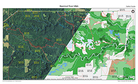
Blackhoof River WMA was created around 1991 to protect an important White-tailed Deer wintering site and portions of the Blackhoof River and Nemadji River corridors. |
||
Management |
||
Forty wildlife openings and five browse production plots have been created by removing trees and mowing the remaining shrubs. They are re-mowed or sheared every 5 to 10 years. Additional 50′ strips have been mowed to provide habitat for American Woodcock. They are re-mowed every 5 years. More than 18 miles of wide hunter walking trails have been created mostly on upland areas. These are mowed every year. |
||
Comments |
||
|
||
Driving Directions |
 |
|||||
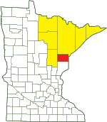
| Carlton County | ||||||
| Northeast Minnesota | ||||||
Activities |
||
Hiking Trails |
||
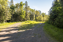
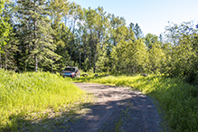
There are 12.9 miles of hunter walking trails. These are as wide as a forest road and are mowed every year. There are 5.3 miles of other walking trails that are also maintained. A DNR access road parallels MN 23 for 2 miles at the east end of the WMA. |
||
Hunting |
||
All hunting. See Hunting and Trapping Regulations (MN DNR) for details. |
||
Ecology |
|||||||
Ecological Classification |
 |
||||||
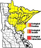
| Ecological Province | Laurentian Mixed Forest Province |
||||||
| Ecological Section | Southern Superior Uplands |
||||||
| Ecological Subsection | Glacial Lake Superior Plain |
||||||
| Land Type Association | Douglas Lake-Modified Till Plain |
||||||
Native Plant Communities* |
|||||||
Alder Swamp / Wet Alder Swamp / Wet-Mesic Boreal Hardwood-Conifer Forest Aspen - Birch - Basswood Forest Aspen - Birch - Red Maple Forest Aspen - Fir Forest Black Ash - Aspen - Balsam Poplar Swamp (Northeastern) Black Ash - Basswood Forest Black Ash - Conifer Swamp (Northeastern) Black Ash - Yellow Birch - Red Maple - Basswood Swamp (Eastcentral) Northern Mesic Hardwood Forest Northern Very Wet Ash Swamp Northern Wet-Mesic Boreal Hardwood-Conifer Forest Poor Black Spruce Swamp |
|||||||
| * Source: The Minnesota Biological Survey, Minnesota Department of Natural Resources, Division of Ecological Resources | |||||||
Natural Features |
|||||||
Blackhoof River WMA contains the confluence of the Blackhoof and Nemadji Rivers, about three miles of each river’s corridor, and the broad upland between. The flat to gently rolling uplands are dissected by the deep valleys of these rivers, and by several ravines created by Deer Creek and other unnamed connecting streams. Areas of old growth forest remain in the river bottoms. |
|||||||

Slideshows |
||
Visitor Videos |
|||
Share your video of this destination. |
|||
| This button not working for you? Simply email us at info@MinnesotaSeasons.com. Attach a video, a YouTube link, or a cloud storage link. |
|||
Other Videos |
|||

Created: Last Updated: © MinnesotaSeasons.com. All rights reserved. |





_05t.jpg)


