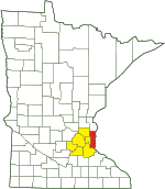
Grey Cloud Dunes SNA
About • Location • Activities • Ecology
About |
Ownership |
|
Links |
Overview |
|
History |
This SNA was designated in 1998. |
Management |
|
Comments |
|
Activities |
Hiking Birding Nature photography Cross country skiing Snowshoeing |
Trails |
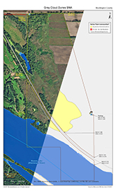
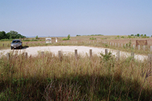
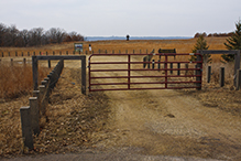
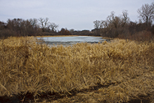
The north parking area is at the corner of a woodland that has a dense, at times impenetrable shrub layer. Two trails lead from this parking area into the SNA. The first, a broad, open trail that doubles as a utility road, leads east to restored prairie on former agricultural fields. At that point the trail turns south and follows the top of the bluff, eventually reaching the south parking area. A second, much more interesting trail leads south through the western edge of the woodland. It emerges at the edge of the site’s only shallow lake and near a tunnel under the railroad tracks that connects the north and south sections of the SNA. A well used trail leads west from the south parking area to the railroad tracks. There are several other trails, really well worn footpaths, on this site, indicating that this metro SNA is often used by the public. On a recent trip there were no cars at the north parking lot when I arrived at 10:30 am on a Sunday. There were five cars in the lot when I left at 3:30 pm. |
Hunting and Fishing |
|
Ecology |
|||||
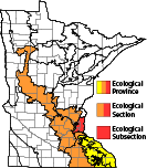
Ecological Classification |
 |
||||
| Ecological Province | Eastern Broadleaf Forest Province |
||||
| Ecological Section | Minnesota & NE Iowa Morainal |
||||
| Ecological Subsection | St. Paul-Baldwin Plains and Moraines |
||||
| Land Type Association | Afton Bedrock Hills |
||||
Native Plant Communities* |
|||||
Dry Barrens Prairie (Southern) |
|||||
| * Source: The Minnesota Biological Survey, Minnesota Department of Natural Resources, Division of Ecological Resources | |||||
Natural Features |
|||||
|
|||||
Oak Grove
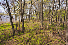
In stark contrast to the dense woods near the north parking area, the wooded section at the southwest corner of the SNA is an oak grove. There is a canopy of tall oak, hackberry, and other trees, but there is no shrub layer. This area is often flooded in the spring.
Railroad Prairie
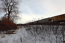
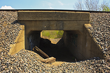
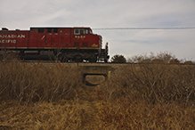
A busy section of the Burlington Northern and Santa Fe Railway separates the north and south sections of the SNA. A tunnel beneath the tracks at the west boundary connects the two sections. Two-thirds of the railway between the sections is designated railroad prairie.
Visitor Photos |
||
Share your photo of this destination. |
||
This button not working for you? |
||
Kirk Nelson |
||
 |
 |
|
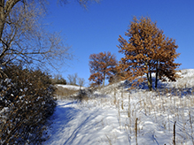
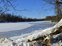
Snowshoeing, 12/11/2021 |
||
 |
 |
|
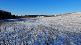
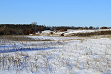
Snowshoeing, 12/11/2021 |
||
 |
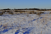 |
|
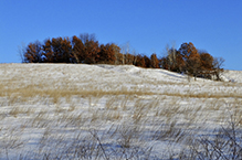
Snowshoeing, 12/11/2021 |
||
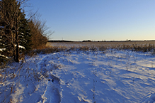 |
||
Snowshoeing, 12/11/2021 |
||
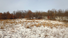 |
 |
|
Oak Woods in Late Winter |
||
|
||
|
||
|
Oak Woods in Late Winter |
|
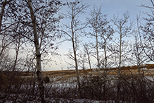 |
 |
|
Looking Out from the Treeline near the Railroad Tracks |
Train | |
MinnesotaSeasons.com Photos |
||
North Section |
||
 |
 |
|
South Parking |
||
 |
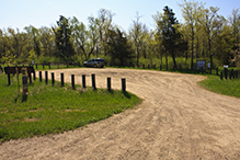 |
|
The south parking area is sometimes closed. |
North Parking | |
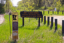 |
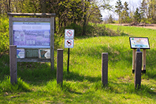 |
|
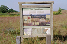
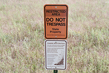
Signage |
||
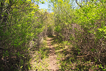 |
 |
|
Trails |
||
|
||
|
||
|
Trails | |
Shallow Lake |
||
 |
||
 |
 |
|
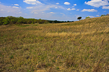
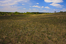
Knapweed Control Area |
||
 |
 |
|
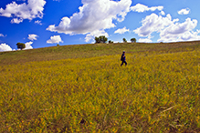
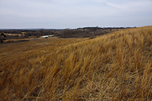
Dry Barrens Prairie (Southern) |
||
 |
 |
|
Dry Barrens Prairie (Southern) |
||
South Section |
||
 |
 |
|
Tunnel Under Railroad Tracks |
||
 |
 |
|
Dry Barrens Prairie (Southern) |
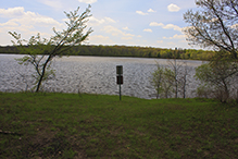
Mooers Lake (Mississippi River) | |
 |
 |
|
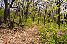
Oak Woodland |
Oak Grove | |
 |
 |
|
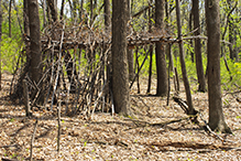
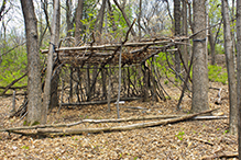
Man-made Shelter |
||

Slideshows |
Grey Cloud Dunes SNA |
|
Grey Cloud Dunes SNA |

|
About
Grey Cloud Dunes encompasses two sandy terraces along the Mississippi River. The first, 40 to 60 feet above the river, is remarkable for its crescents and blowouts sculpted by southwesterly winds. The second, 110 feet above the river, has a dramatic cut-face. These river terraces mark the height of the river at various periods following the melting and retreat of the continental glaciers. |
Visitor Videos |
||
Share your video of this destination. |
||
This button not working for you? |
||
|
Other Videos |
||
Grey Cloud Dunes Scientific and Natural Area Virtual Hike |
About
Apr 2, 2020 Take a hike out onto the high terrace at Grey Cloud Dunes SNA. You’ll see a spectacular view of the Mississippi River. It’s a treat any time of year, but was especially nice in November, when this video was taken during a seed collection event on the site. This site was designated on December 30, 1998. mndnr.gov/snas/sna01101 |
Nature Specials Gone Badly Wrong: Episode 4, "The Sparrow Deer" |
About
June 14, 2011 This video represents what happens when to much deet is ingested with Nicotine. After seeing a bizzilion sparrows, one gets a bit punchy. Facts were not checked after the release of this video. It takes place at Grey Cloud Dunes Scientific and Natural Area. This unique prairie is located on sandy terraces 60 and 110 feet above the present Mississippi River. Formed by the out-wash of the greatly enhanced glacial Mississippi, sand dunes resulted in crescent shapes or blow outs from SW winds. The place is a damn sparrow jamberoo, with over 8 different species. Plus isolated scrub is colonized by Orchard Orioles, Brown Thrashers, Bells Vireos, Alder Flycatchers, Eastern Meadowlarks and Yellow-Billed Cuckoos among many other |
Grey Cloud Dunes |
About
Published on Mar 11, 2017 3.11.2017 |

Visitor Sightings |
|
Share your sightings or comments about of this destination. |
|
This button not working for you? |
|
Kirk Nelson |
||
Insects and Arachnids |
||
| bald-faced hornet (Dolichovespula maculata) |  |
|
Plants |
||
| American bittersweet (Celastrus scandens) |  |
|
MinnesotaSeasons.com Sightings |
Visits |
8/12/2000 9/13/2009 8/10/2013 5/18/2014 3/12/2015 |
Amphibians |
||
Birds |
||||||||||
|
||||||||||
American Crow (Corvus brachyrhynchos) American Goldfinch (Spinus tristis) American Redstart (Setophaga ruticilla) American Robin (Turdus migratorius) Bald Eagle (Haliaeetus leucocephalus) Baltimore Oriole (Icterus galbula) Barn Swallow (Hirundo rustica) Black-capped Chickadee (Poecile atricapillus) Blue Jay (Cyanocitta cristata) Blue-winged Teal (Spatula discors) Brown Thrasher (Toxostoma rufum) Brown-headed Cowbird (Molothrus ater) Canada Goose (Branta canadensis) Common Yellowthroat (Geothlypis trichas) Double-crested Cormorant (Phalacrocorax auritus) Downy Woodpecker (Dryobates pubescens) Eastern Bluebird (Sialia sialis) Eastern Kingbird (Tyrannus tyrannus) Eastern Towhee (Pipilo erythrophthalmus) Field Sparrow (Spizella pusilla) Gray Catbird (Dumetella carolinensis) Great Blue Heron (Ardea herodias) Green Heron (Butorides virescens) Hairy Woodpecker (Leuconotopicus villosus) House Wren (Troglodytes aedon) Mourning Dove (Zenaida macroura) Northern Cardinal (Cardinalis cardinalis) Northern Flicker (Colaptes auratus) Olive-sided Flycatcher (Contopus cooperi) Pileated Woodpecker (Dryocopus pileatus) Red-bellied Woodpecker (Melanerpes carolinus) Red-tailed Hawk (Buteo jamaicensis) Red-winged Blackbird (Agelaius phoeniceus) Ring-necked Pheasant (Phasianus colchicus) Rose-breasted Grosbeak (Pheucticus ludovicianus) Song Sparrow (Melospiza melodia) Tree Swallow (Tachycineta bicolor) Turkey Vulture (Cathartes aura) White-breasted Nuthatch (Sitta carolinensis) White-crowned Sparrow (Zonotrichia leucophrys) Wild Turkey (Meleagris gallopavo) |
||||||||||
Fishes |
||
Fungi and Lichens |
||
Crown Rust (Puccinia coronata) False Death Cap (Amanita citrina) False Turkey Tail (Stereum ostrea) Gray False Death Cap (Amanita citrina var. grisea) |
 |
|
Insects and Arachnids |
||
bald-faced hornet (Dolichovespula maculata) blue orchard bee (Osmia lignaria lignaria) Carolina grasshopper (Dissosteira carolina) common green darner (Anax junius) common harvestman (Phalangium opilio) coral-winged grasshopper (Pardalophora apiculata) dog day cicada (Neotibicen canicularis) fraternal potter wasp (Eumenes fraternus) goldenrod bunch gall midge (Rhopalomyia solidaginis) goldenrod gall fly (Eurosta solidaginis) goldenrod soldier beetle (Chauliognathus pennsylvanicus) great black digger wasp (Sphex pensylvanicus) migratory grasshopper (Melanoplus sanguinipes) oak rough bulletgall wasp (Disholcaspis quercusmamma) orange-winged grasshopper (Pardalophora phoenicoptera) red-legged grasshopper (Melanoplus femurrubrum) Summer Azure (Celastrina neglecta) velvet ant (Dasymutilla sp.) |
||
Mammals |
||
American Beaver (Castor canadensis) Plains Pocket Gopher (Geomys bursarius) Thirteen-lined Ground Squirrel (Ictidomys tridecemlineatus) |
 |
|
Plants |
||||||||||
|
||||||||||
Minnesota Biodiversity Atlas and Minnesota Biological Survey Vegetation Releves Plant List |
||||||||||
Plants frequently found in: |
||||||||||
|
absinthe wormwood (Artemisia absinthium) American basswood (Tilia americana var. americana) American plum (Prunus americana) American red raspberry (Rubus idaeus ssp. strigosus) American stinging nettle (Urtica gracilis ssp. gracilis) bastard toadflax (Comandra umbellata ssp. umbellata) big bluestem (Andropogon gerardi) birdfoot violet (Viola pedata) bitternut hickory (Carya cordiformis) black bindweed (Fallopia convolvulus) black cherry (Prunus serotina var. serotina) black medick (Medicago lupulina) black-seeded plantain (Plantago rugelii var. rugelii) bland sweet cicely (Osmorhiza claytonii) bloodroot (Sanguinaria canadensis) boxelder (Acer negundo var. negundo) bracted spiderwort (Tradescantia bracteata) bur oak (Quercus macrocarpa var. macrocarpa) butter and eggs (Linaria vulgaris) Canada anemone (Anemonastrum canadense) Canada goldenrod (Solidago canadensis) Canada moonseed (Menispermum canadense) Canada wildrye (Elymus canadensis) Canadian horseweed (Erigeron canadensis) Canadian milkvetch (Astragalus canadensis var. canadensis) Canadian tick-trefoil (Desmodium canadense) chokecherry (Prunus virginiana var. virginiana) clammy groundcherry (Physalis heterophylla) Cleland’s evening primrose (Oenothera clelandii) common blue violet (Viola sororia) common buckthorn (Rhamnus cathartica) common burdock (Arctium minus) common dandelion (Taraxacum officinale) common evening primrose (Oenothera biennis) common hackberry (Celtis occidentalis) common milkweed (Asclepias syriaca) common motherwort (Leonurus cardiaca ssp. cardiaca) common mullein (Verbascum thapsus ssp. thapsus) common ragweed (Ambrosia artemisiifolia) common yarrow (Achillea millefolium) curly-cup gumweed (Grindelia squarrosa) early figwort (Scrophularia lanceolata) early meadow-rue (Thalictrum dioicum) eastern black nightshade (Solanum emulans) eastern false rue anemone (Enemion biternatum) eastern prickly gooseberry (Ribes cynosbati) eastern redcedar (Juniperus virginiana var. virginiana) field pussytoes (Antennaria neglecta) field sagewort (Artemisia campestris ssp. caudata) fragrant bedstraw (Galium triflorum) garlic mustard (Alliaria petiolata) giant foxtail (Setaria faberi) gray dogwood (Cornus racemosa) gray goldenrod (Solidago nemoralis) green amaranth (Amaranthus hybridus) green ash (Fraxinus pennsylvanica) green foxtail (Setaria viridis var. viridis) ground ivy (Glechoma hederacea) hairy false goldenaster (Heterotheca villosa) heart-leaved four o’clock (Mirabilis nyctaginea) hoary alyssum (Berteroa incana) hoary vervain (Verbena stricta) Illinois tick-trefoil (Desmodium illinoense) Indiangrass (Sorghastrum nutans) Jerusalem artichoke (Helianthus tuberosus) kidney-leaved buttercup (Ranunculus abortivus) large-flowered beardtongue (Penstemon grandiflorus) little bluestem (Schizachyrium scoparium) long-spine sandbur (Cenchrus longispinus) marijuana (Cannabis sativa var. sativa) Maximilian’s sunflower (Helianthus maximiliani) Missouri gooseberry (Ribes missouriense) narrow-leaved cattail (Typha angustifolia) narrow-leaved hawk’s-beard (Crepis tectorum) narrow-leaved hawkweed (Hieracium umbellatum) northern pin oak (Quercus ellipsoidalis) northern red oak (Quercus rubra) ostrich fern (Matteuccia struthiopteris var. pensylvanica) Parlin’s pussytoes (Antennaria parlinii) partridge pea (Chamaecrista fasciculata var. fasciculata) Pennsylvania smartweed (Persicaria pensylvanica) plains cottonwood (Populus deltoides ssp. molinifera) plains snake-cotton (Froelichia floridana var. campestris) prairie smoke (Geum triflorum var. triflorum) prairie spiderwort (Tradescantia occidentalis var. occidentalis) prairie sunflower (Helianthus petiolaris ssp. petiolaris) purple lovegrass (Eragrostis spectabilis) purple prairie clover (Dalea purpurea var. purpurea) quaking aspen (Populus tremuloides) rabbit’s foot clover (Trifolium arvense) rabbit-tobacco (Pseudognaphalium obtusifolium) red clover (Trifolium pratense) rough blazing star (Liatris aspera var. intermedia) rough cinquefoil (Potentilla norvegica) rough cocklebur (Xanthium strumarium) rough false pennyroyal (Hedeoma hispida) round-headed bush clover (Lespedeza capitata) rush skeletonplant (Lygodesmia juncea) sensitive fern (Onoclea sensibilis) showy goldenrod (Solidago speciosa) silky aster (Symphyotrichum sericeum) silky prairie clover (Dalea villosa var. villosa) silvery cinquefoil (Potentilla argentea) smooth scouring rush (Equisetum laevigatum) smooth Solomon’s seal (Polygonatum biflorum var. commutatum) spotted knapweed (Centaurea stoebe ssp. micranthos) starry false Solomon’s seal (Maianthemum stellatum) stiff goldenrod (Solidago rigida ssp. rigida) stiff sunflower (Helianthus pauciflorus ssp. subrhomboideus) stiffleaf false goldenaster (Heterotheca angustifolia) tall cinquefoil (Drymocallis arguta) Tatarian honeysuckle (Lonicera tatarica) velvet-leaf (Abutilon theophrasti) Virginia groundcherry (Physalis virginiana var. virginiana) Virginia waterleaf (Hydrophyllum virginianum var. virginianum) western ragweed (Ambrosia psilostachya) white campion (Silene latifolia ssp. alba) white heath aster (Symphyotrichum ericoides var. ericoides) white prairie clover (Dalea candida var. candida) white sage (Artemisia ludoviciana ssp. ludoviciana) white snakeroot (Ageratina altissima var. altissima) white sweet clover (Melilotus albus) whorled milkweed (Asclepias verticillata) wild geranium (Geranium maculatum) wild sarsaparilla (Aralia nudicaulis) wolfberry (Symphoricarpos occidentalis) woodbine (Parthenocissus vitacea) woolly plantain (Plantago patagonica) yellow foxtail (Setaria pumila ssp. pumila) yellow goat’s beard (Tragopogon dubius)
Abutilon theophrasti (velvet-leaf) Acer negundo var. negundo (boxelder) Achillea millefolium (common yarrow) Ageratina altissima var. altissima (white snakeroot) Alliaria petiolata (garlic mustard) Amaranthus hybridus (green amaranth) Ambrosia artemisiifolia (common ragweed) Ambrosia psilostachya (western ragweed) Andropogon gerardi (big bluestem) Anemonastrum canadense (Canada anemone) Antennaria neglecta (field pussytoes) Antennaria parlinii (Parlin’s pussytoes) Aralia nudicaulis (wild sarsaparilla) Arctium minus (common burdock) Artemisia absinthium (absinthe wormwood) Artemisia campestris ssp. caudata (field sagewort) Artemisia ludoviciana ssp. ludoviciana (white sage) Asclepias syriaca (common milkweed) Asclepias verticillata (whorled milkweed) Astragalus canadensis var. canadensis (Canadian milkvetch) Berteroa incana (hoary alyssum) Cannabis sativa var. sativa (marijuana) Carya cordiformis (bitternut hickory) Celtis occidentalis (common hackberry) Cenchrus longispinus (long-spine sandbur) Centaurea stoebe ssp. micranthos (spotted knapweed) Chamaecrista fasciculata var. fasciculata (partridge pea) Comandra umbellata ssp. umbellata (bastard toadflax) Cornus racemosa (gray dogwood) Crepis tectorum (narrow-leaved hawk’s-beard) Dalea candida var. candida (white prairie clover) Dalea purpurea var. purpurea (purple prairie clover) Dalea villosa var. villosa (silky prairie clover) Desmodium canadense (Canadian tick-trefoil) Desmodium illinoense (Illinois tick-trefoil) Drymocallis arguta (tall cinquefoil) Elymus canadensis (Canada wildrye) Enemion biternatum (eastern false rue anemone) Equisetum laevigatum (smooth scouring rush) Eragrostis spectabilis (purple lovegrass) Erigeron canadensis (Canadian horseweed) Fallopia convolvulus (black bindweed) Fragaria virginiana (wild strawberry) Fraxinus pennsylvanica (green ash) Froelichia floridana var. campestris (plains snake-cotton) Galium triflorum (fragrant bedstraw) Geranium maculatum (wild geranium) Geum triflorum var. triflorum (prairie smoke) Glechoma hederacea (ground ivy) Grindelia squarrosa (curly-cup gumweed) Hedeoma hispida (rough false pennyroyal) Helianthus maximiliani (Maximilian’s sunflower) Helianthus pauciflorus ssp. subrhomboideus (stiff sunflower) Helianthus petiolaris ssp. petiolaris (prairie sunflower) Helianthus tuberosus (Jerusalem artichoke) Heterotheca angustifolia (stiffleaf false goldenaster) Heterotheca villosa (hairy false goldenaster) Hieracium umbellatum (narrow-leaved hawkweed) Hydrophyllum virginianum var. virginianum (Virginia waterleaf) Juniperus virginiana var. virginiana (eastern redcedar) Leonurus cardiaca ssp. cardiaca (common motherwort) Lespedeza capitata (round-headed bush clover) Liatris aspera var. intermedia (rough blazing star) Linaria vulgaris (butter and eggs) Lonicera tatarica (Tatarian honeysuckle) Lygodesmia juncea (rush skeletonplant) Maianthemum stellatum (starry false Solomon’s seal) Matteuccia struthiopteris var. pensylvanica (ostrich fern) Medicago lupulina (black medick) Melilotus albus (white sweet clover) Melilotus officinalis (yellow sweet clover) Menispermum canadense (Canada moonseed) Mirabilis nyctaginea (heart-leaved four o’clock) Oenothera biennis (common evening primrose) Oenothera clelandii (Cleland’s evening primrose) Onoclea sensibilis (sensitive fern) Osmorhiza claytonii (bland sweet cicely) Oxalis stricta (yellow wood sorrel) Parthenocissus vitacea (woodbine) Penstemon grandiflorus (large-flowered beardtongue) Persicaria pensylvanica (Pennsylvania smartweed) Physalis heterophylla (clammy groundcherry) Physalis virginiana var. virginiana (Virginia groundcherry) Plantago patagonica (woolly plantain) Plantago rugelii var. rugelii (black-seeded plantain) Polygonatum biflorum var. commutatum (smooth Solomon’s seal) Populus deltoides ssp. molinifera (plains cottonwood) Populus tremuloides (quaking aspen) Potentilla argentea (silvery cinquefoil) Potentilla norvegica (rough cinquefoil) Prunus americana (American plum) Prunus serotina var. serotina (black cherry) Prunus virginiana var. virginiana (chokecherry) Pseudognaphalium obtusifolium (rabbit-tobacco) Quercus ellipsoidalis (northern pin oak) Quercus macrocarpa var. macrocarpa (bur oak) Quercus rubra (northern red oak) Ranunculus abortivus (kidney-leaved buttercup) Rhamnus cathartica (common buckthorn) Ribes cynosbati (eastern prickly gooseberry) Ribes missouriense (Missouri gooseberry) Rubus idaeus ssp. strigosus (American red raspberry) Sanguinaria canadensis (bloodroot) Schizachyrium scoparium (little bluestem) Scrophularia lanceolata (early figwort) Setaria faberi (giant foxtail) Setaria pumila ssp. pumila (yellow foxtail) Setaria viridis var. viridis (green foxtail) Silene latifolia ssp. alba (white campion) Solanum emulans (eastern black nightshade) Solidago canadensis (Canada goldenrod) Solidago nemoralis (gray goldenrod) Solidago rigida ssp. rigida (stiff goldenrod) Solidago speciosa (showy goldenrod) Sorghastrum nutans (Indiangrass) Symphoricarpos occidentalis (wolfberry) Symphyotrichum ericoides var. ericoides (white heath aster) Symphyotrichum sericeum (silky aster) Taraxacum officinale (common dandelion) Thalictrum dioicum (early meadow-rue) Tilia americana var. americana (American basswood) Tradescantia bracteata (bracted spiderwort) Tradescantia occidentalis var. occidentalis (prairie spiderwort) Tragopogon dubius (yellow goat’s beard) Trifolium arvense (rabbit’s foot clover) Trifolium pratense (red clover) Typha angustifolia (narrow-leaved cattail) Urtica gracilis ssp. gracilis (American stinging nettle) Verbascum thapsus ssp. thapsus (common mullein) Verbena stricta (hoary vervain) Viola pedata (birdfoot violet) |
||||||||||
Reptiles |
||||||||
|
||||||||
| Painted Turtle (Chrysemys picta) |  |
|||||||
Created: Last Updated: © MinnesotaSeasons.com. All rights reserved. |

