![]()
![]()
![]()
![]()
Hastings Sand Coulee SNA
About • Location • Activities • Ecology
About |
||
Ownership |
||
|
||
Links |
||
Overview |
||
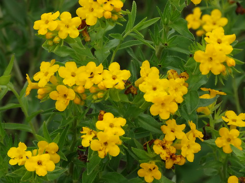
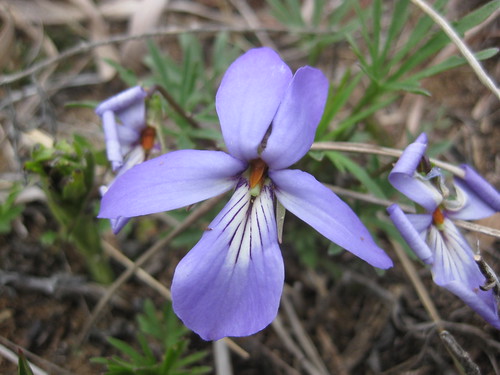
Hastings Sand Coulee Scientific and Natural Area (SNA) was first designated in 2007 and greatly expanded in 2011. The Minnesota Biological Survey identified this site as “one of the most biologically important sites in Dakota County.” An unnamed intermittent stream, a tributary of the Vermillion River, runs through all three of the disconnected units of this SNA. The South Unit is a 79-acre dry prairie with scattered eastern redcedar. The North Unit is 178 acres and includes a more diverse mix of dry prairie, oak woodland, and former cropland being restored to prairie. The tiny, 6¾-acre Center Unit is an abandoned gravel pit. It is not accessible without crossing private property. |
||
History |
||
On June 27, 2007, this site was designated Sand Coulee Scientific and Natural Area. In 2011 the Minnesota DNR acquired 185 acres of property in Hastings. The newly acquired land became the North and Central Units of Hasting Sand Coulee SNA. |
||
Management |
||
The Friends of the Mississippi River has done considerable work restoring this site. On the North Unit, this is especially apparent on the eastern slope. Following decades of fire suppression, what had once been a hill prairie had become bur oak woodland with a dense shrub understory. Most of the shrub layer in this section was removed in December, 2013. The following spring the area was reseeded with seeds harvested in the area. The large area of former cropland on the eastern half of the unit has been reseeded with prairie grasses and forbs. On the South Unit, buckthorn has been cut in the area bordering MN 361. |
||
Comments |
||
|
||
Location |
||||
Maps |
||||
Printable Map(s) with GPS coordinates |
||||
Complete |
||||
 |
||||
North Unit |
South Unit |
|||
 |
 |
|||
Size |
||||
North Unit: 178 Acres Center Unit: 6.75 acres South Unit: 79 acres |
||||
Parking |
||||
North Unit (Stormwater Utility) N44 41.608, W92 49.073 |
||||
Driving Directions |
 |
|||||
| Dakota County | ||||||
| Metro Area | ||||||
Activities |
||
Hiking Trails |
||
There are no maintained hiking trails. A maintained snowmobile trail, Dakota County Trails Snowmobile Trail 123, passes through the south unit. |
||
Hunting |
||
No hunting |
||
Ecology |
|||||||
Ecological Classification |
 |
||||||
| Ecological Province | Eastern Broadleaf Forest Province |
||||||
| Ecological Section | Minnesota & NE Iowa Morainal |
||||||
| Ecological Subsection | Oak Savanna |
||||||
| Land Type Association | Coates Sand Plain |
||||||
Native Plant Communities* |
|||||||
Dry Sand - Gravel Prairie (Southern) |
|||||||
| * Source: The Minnesota Biological Survey, Minnesota Department of Natural Resources, Division of Ecological Resources | |||||||
Natural Features |
|||||||
|
|||||||
Visitor Photos |
|||||
Share your photo of this destination. |
|||||
| This button not working for you? Simply email us at info@MinnesotaSeasons.com. Attach one or more photos and, if you like, a caption. |
|||||
|
|||||
MinnesotaSeasons.com Photos |
|||||
South Unit |
|||||
Parking |
|||||
 |
 |
||||
Wood Routed Sign |
|||||
 |
|||||
Other Prairie |
|||||
 |
|||||
North Unit |
|||||
Parking |
|||||
 |
|||||
Interpretive Sign |
|||||
 |
|||||
Boot Brush |
|||||
 |
|||||
North Entrance |
|||||
 |
|||||
Dry Barrens Prairie (Southern) |
|||||
 |
 |
||||
Dry Sand - Gravel Prairie (Southern) |
|||||
 |
 |
||||
Other Prairie |
|||||
 |
 |
||||
Intermittent Stream |
|||||
 |
 |
||||

Slideshows |
||
| Sand Coulee SNA Restoration Evaluation |
||
|
||
| Flora of Hastings Sand Coulee SNA Mikes Orchids |
||
|
||
About
A photo gallery of various plants growing in the Hastings Sand Coulee Scientific and Natural Area just south of Hastings, Minnesota. |
||

Visitor Videos |
|||
Share your video of this destination. |
|||
| This button not working for you? Simply email us at info@MinnesotaSeasons.com. Attach a video, a YouTube link, or a cloud storage link. |
|||
Other Videos |
|||
| Hastings Sand Coulee Michael Myers |
|||
About
Published on Feb 18, 2017 2.18.2017 |
|||


")


")
_04.jpg "prairie fleabane (var. strigosus)")


Created: Last Updated: © MinnesotaSeasons.com. All rights reserved. |